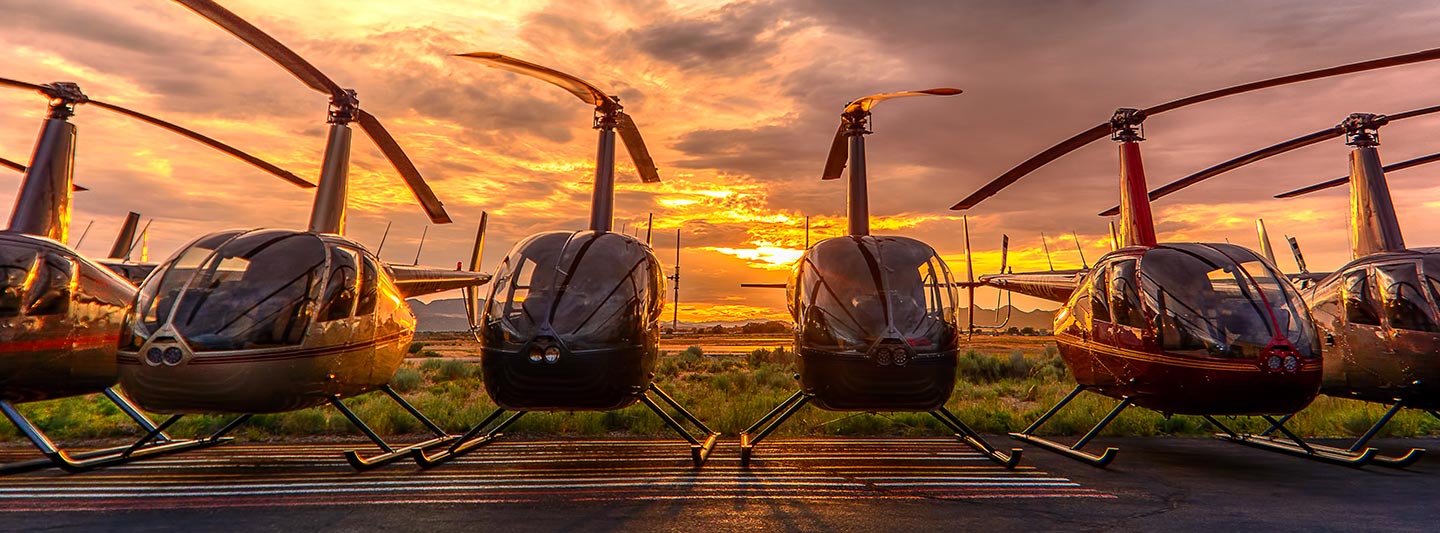
Great Falls Aerial Services: Surveys, Photography, and Cinematography
Your Strategic Aerial Vantage for Montana
For any aerial survey requirement across Montana, from precise magnetometer and electromagnetic surveys to advanced LiDAR and comprehensive GIS mapping, Great Falls Helicopter Charters delivers unparalleled solutions. Our capabilities leverage the helicopter's unique low-altitude flight and stable hover characteristics, ensuring optimal data acquisition and detailed imagery across varied terrains, including the rugged landscapes around Glacier National Park and the agricultural plains of Central Montana. Furthermore, we specialize in advanced aerial cinematography and photography services, providing access to cutting-edge technology for precision filming, or facilitating door-off operations for dynamic handheld capture. We are committed to equipping your project with the exact aerial platform and specialized gear to achieve superior visual and data-driven results.
Aerial
Surveys
LiDAR, GIS Maps, FLIR, HD Video & More
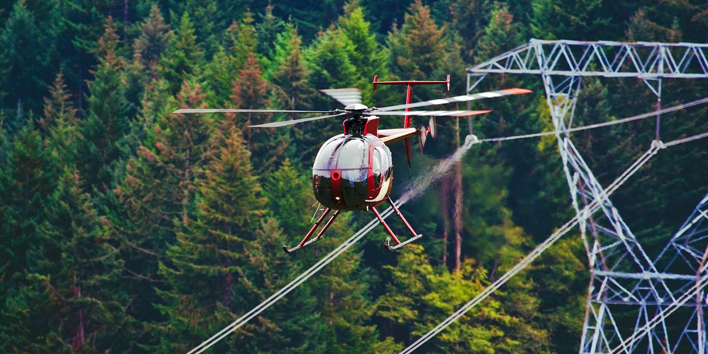
For critical infrastructure projects, including comprehensive pipeline inspections, right-of-way assessments, and rigorous transmission line patrols throughout Montana, Great Falls Helicopter Charters provides optimal aerial solutions. We coordinate the deployment of suitable aircraft, integrated with advanced inspection equipment, to ensure precise data capture and efficient project execution. Our focus is on delivering accurate and timely results for your operational objectives.
High Tech Results
The Top Pilots in Montana, Today's Technology... Maximum Results.
Call 1-866-826-4826 Now!
Great Falls Helicopter Charters provides the tools needed to complete your land surveys, utilizing the right equipment to provide the aerial photos that are often needed.
Leveraging precision aerial surveys simplifies complex right-of-way and site inspections, streamlines topographical data acquisition, and enables high-definition photographic capture for commercial development projects across Montana. Helicopter-based surveys offer an unparalleled vantage for scrutinizing the diverse terrain of the Rocky Mountain Front, systematically inspecting vital pipelines for integrity issues, proactively identifying anomalies in transmission line infrastructure, or capturing comprehensive visual documentation of properties. Great Falls Helicopter Charters specializes in designing bespoke photographic and remote sensing operations. These custom solutions are engineered to integrate seamlessly with your project's technical specifications and budgetary constraints, ensuring maximum operational efficiency and superior, actionable results.
The inherent operational flexibility of a helicopter, characterized by its capacity for low-altitude, low-airspeed flight and stable hover, positions it as the optimal platform for precision aerial surveying. Unlike fixed-wing aircraft, which are typically restricted by FAA regulations to a minimum of 1,000 feet above the highest obstacle, helicopters can operate at significantly lower altitudes. This capability is crucial for acquiring granular data and detailed visual inspections, particularly in complex or restricted airspace around Great Falls. Furthermore, helicopters facilitate safe and direct access to hazardous or otherwise inaccessible zones, providing engineers and project managers with critical perspectives unattainable through alternative means, thereby enhancing safety protocols and operational insights.
There is no better way to conduct your visual survey, animal population counts, soil drainage analysis, ROW inspections, pipeline and transmission line inspections, and geographical surveys.
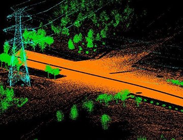
LiDAR Imaging
Light Detection and Ranging, or LiDAR, is a remote sensing method used to examine and measure Montana topography as well as objects, like vegetation, upon it.
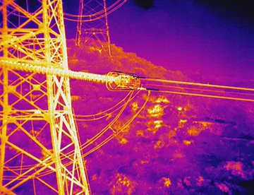
Infrared Imaging
Thermographic IR cameras are used to detect radiation in the long-infrared range of the electromagnetic spectrum and produce images of that radiation, called thermograms.
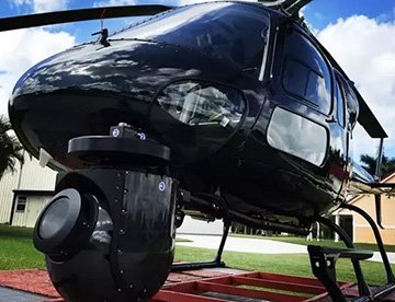
HD Video Gimbal Capture
Modern HD and 4K cameras can be mounted to helicopters, using the proper STCs, with a gimbal to stabilize photos & videos for detailed results.
Precision Aerial Filming and Professional Cinematography Solutions
For expert camera work in the Great Falls Sky
Get a Fast, free QuoteGreat Falls Aerial Cinematography
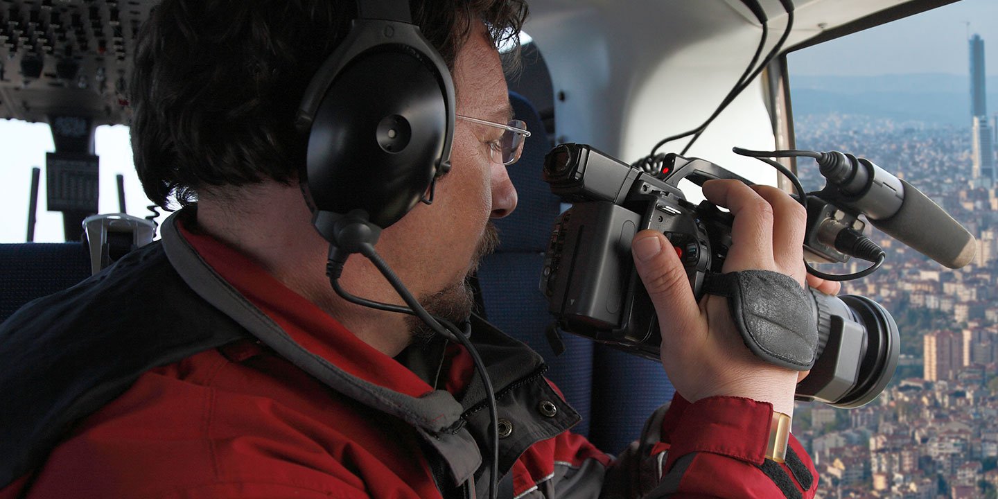
Great Falls Helicopter Charters provides unparalleled access to comprehensive resources for professional-grade aerial cinematography across Montana. We facilitate bespoke aerial shoots by deploying the latest in gyro-stabilized camera mounting systems, including industry-standard Tyler Mounts, Wesscam, Cineflex, Pictorvision, and SpaceCam. These platforms integrate seamlessly with high-performance specialty cameras such as Cineflex HD, RED Epic, and Arri Alexa, alongside advanced 3D and experimental camera systems, to capture breathtaking visuals. Whether your project demands dynamic air-to-air sequences or precise ground-to-air perspectives, we offer robust support for every facet of your production goals. Our operational personnel are adept at collaborating closely with aerial Directors of Photography and production teams to translate their creative vision into superior visual content. Specializing in both still and motion aerial photography, Great Falls Helicopter Charters is equipped to support a vast array of media operations throughout Montana, including feature films, television series, documentary production, promotional videos, commercials, aerial prop deployment, essential relief work for news networks, and comprehensive coverage of historical or major sporting events, utilizing a diverse fleet of helicopters tailored to specific project requirements.
Call Us Today at 1-866-826-4826 for a Free Quote
Contact Us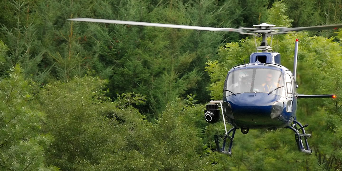
Aerial Photos
Hand-held or Mounted OpTions in Great Falls
We will help you get the right equipment for your aerial photography project! Call 1-866-826-4826 today to get a fast, free quote.
The Most Options for Photography
The unparalleled grandeur of Montana's landscapes, from the Missouri River's vastness near Great Falls to the peaks of the Little Belt Mountains, finds its ultimate capture from an aerial perspective. Great Falls Helicopter Charters specializes in aerial photography charters meticulously designed to translate your precise visual objectives into stunning reality. We provide the technical capabilities and platforms necessary to secure images that truly reflect your artistic vision, delivering superior results for professional portfolios, environmental documentation, or commercial marketing. Clients benefit from a range of aircraft configurations, including the option for door-off operations to facilitate dynamic handheld photography. For projects demanding the utmost stability and precision, we also facilitate access to advanced gyro-stabilized mounting systems, ensuring crisp, high-fidelity image capture under diverse flight conditions. We are committed to delivering exceptional photographic opportunities that optimize both creative output and project value throughout Montana.
Superior Service
Every one of our customers gets a dedicated helicopter expert to assist with flight plans, tech loadouts, production logistics, project schedules, and other demands.
Over 500 Aircraft
Our network of direct air partners extends well beyond Great Falls, Montana. This allows us to offer a wide range of solutions for even the most sophisticated projects.
The Best Equipment
From high-tech sensors like LiDAR, FLIR, and GIS to HD cameras and movie production gimbals, we're here to make your job as easy as possible.


